Geological Archive · 1821–2025
Iceland's
200 Years
of Eruptions
A comprehensive chronicle of every confirmed volcanic eruption on the world's most volcanically active island — from the catastrophic 1875 Askja eruption to the ongoing Sundhnúkur series threatening Grindavík today.
The Land of Fire and Ice
Iceland sits astride the Mid-Atlantic Ridge, where the Eurasian and North American tectonic plates are pulling apart at a rate of approximately 2.5 centimetres per year. This, combined with a deep mantle hotspot directly beneath the island, makes Iceland one of the most volcanically active places on Earth. Over 30 active volcanic systems are distributed across the island, and eruptions occur on average every 3–5 years.
The last 200 years have seen eruptions ranging from the catastrophic — the 1875 Askja eruption that triggered mass emigration, the 1918 Katla jökulhlaup that briefly exceeded the flow of the Amazon River — to the spectacular and accessible, such as the 2021 Fagradalsfjall eruption that drew hundreds of thousands of visitors. Most recently, the Sundhnúkur eruption series beginning in December 2023 has brought volcanic hazard directly to the doorstep of the town of Grindavík.
Volcanic Zones
VEI Scale
Interactive Map
Eruption Locations
Click any marker to view eruption details. Marker size reflects VEI intensity.

Volcanic Zones
Filter by century:
19th Century
AI reconstruction of the 1821 Eyjafjallajökull eruption, showing lava flowing toward Markarfljót (AI-generated)
🤖 AI GeneratedEyjafjallajökull
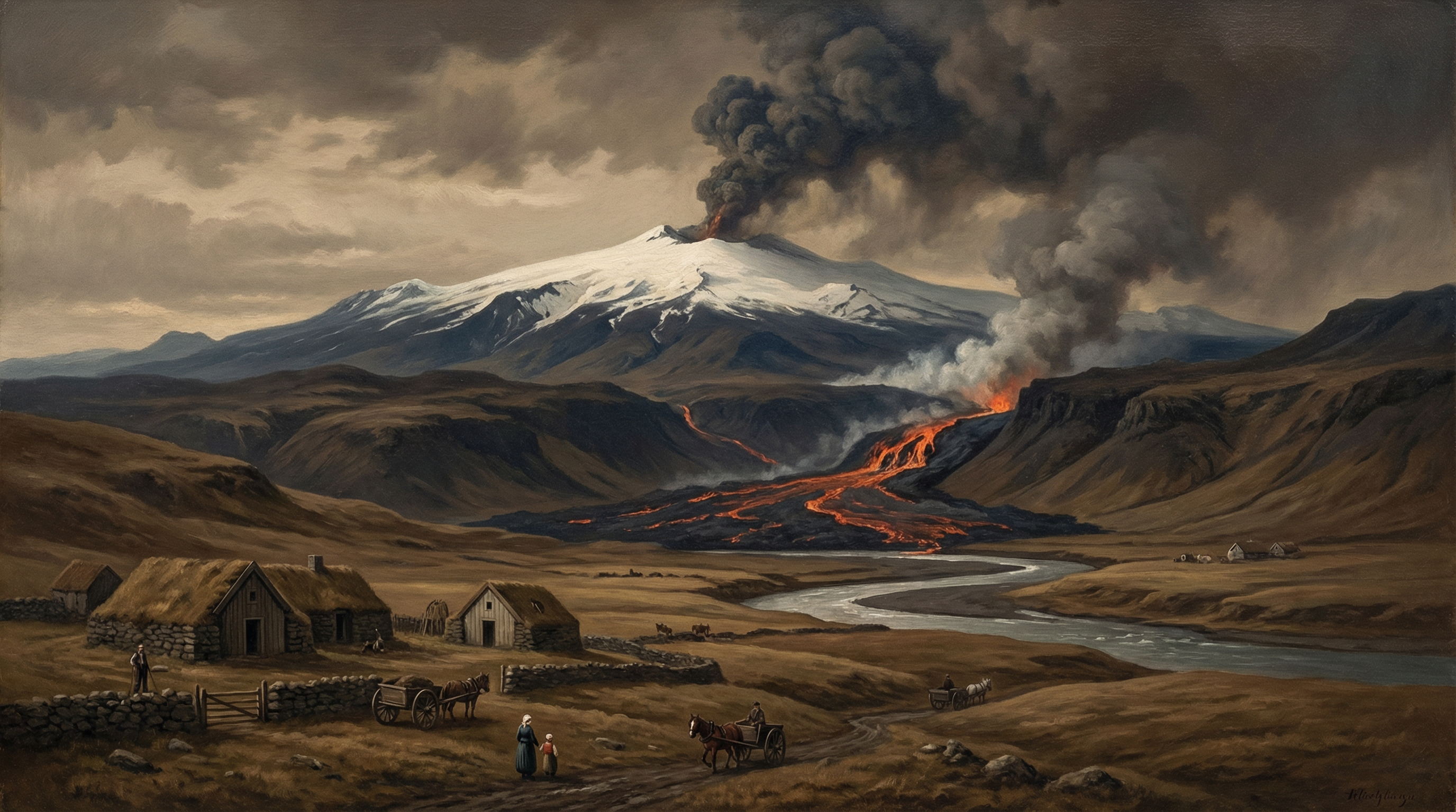
The 1821–1823 eruption of Eyjafjallajökull began weakly on 19 December 1821. Initially no lava flowed, but some ash fell. Subsequently, lava flowed north to Markarfljót river. The eruption was relatively modest compared to the 2010 event, but it demonstrated the volcano's recurring nature and its potential to disrupt the surrounding farmland.
Significance
First recorded eruption of Eyjafjallajökull in the modern era, establishing its eruptive character nearly two centuries before the famous 2010 event.
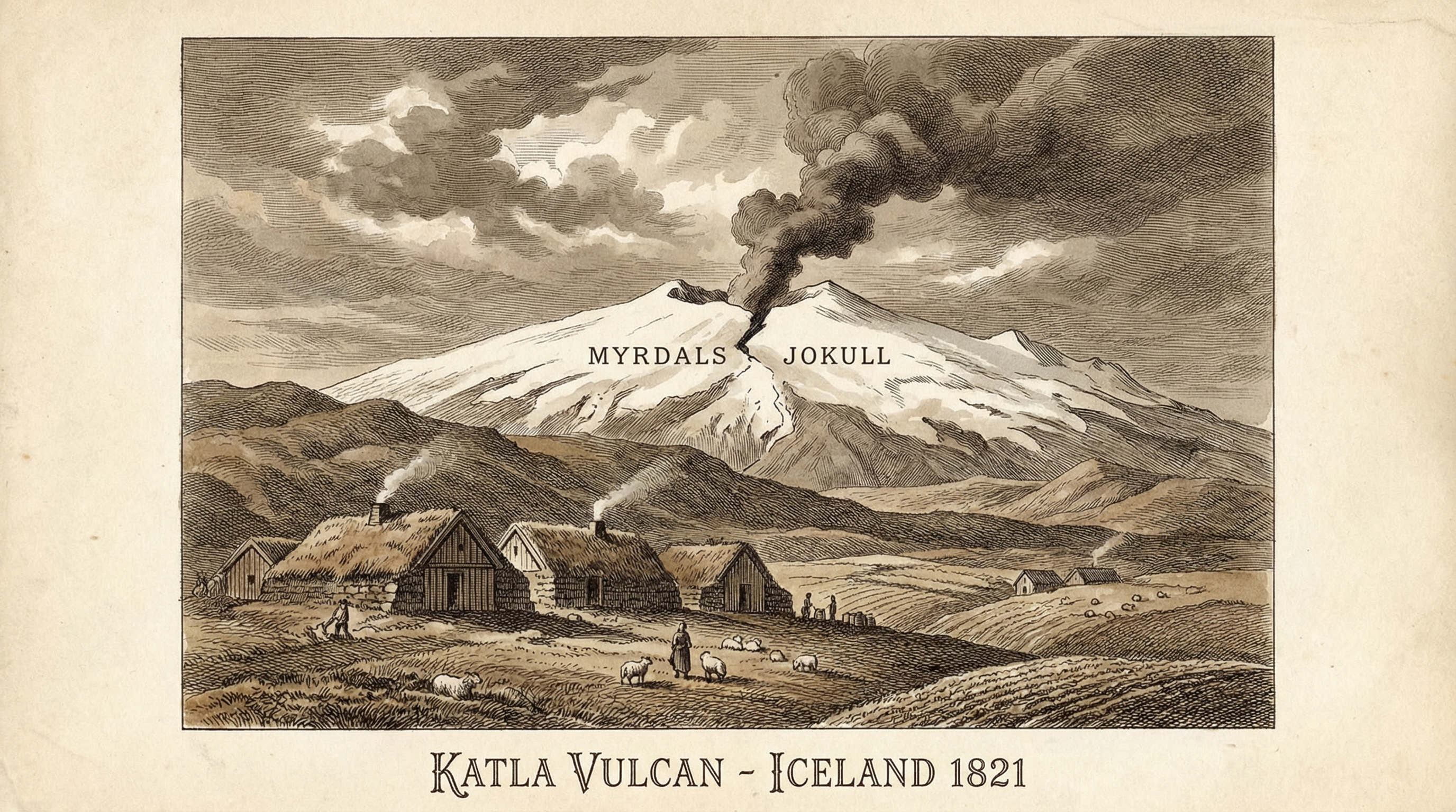
Historical illustration of the 1821 Katla eruption beneath Mýrdalsjökull (AI-generated)
🤖 AI GeneratedKatla
A significant eruption of Katla in 1821, one of Iceland's most active and dangerous volcanoes, located beneath the Mýrdalsjökull ice cap. Katla eruptions are characterised by powerful jökulhlaups (glacial outburst floods) that can reach the coast within hours.
Significance
Part of Katla's regular eruptive cycle, which historically averages one eruption every 40–80 years.
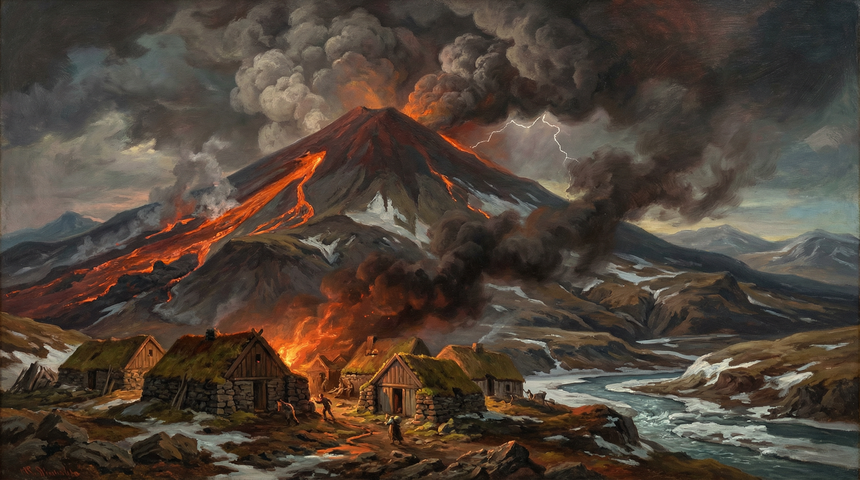
Oil painting reconstruction of the 1845 Hekla eruption threatening Icelandic farms (AI-generated)
🤖 AI GeneratedHekla
Hekla's 13th recorded eruption began on 2 September 1845 and lasted approximately seven months. Heavy ash fell to the southeast and lava flowed west and northwest, covering about 25 km². The farm of Næfurholt had to be relocated as lava advanced into the Ytri-Rangá valley. This eruption followed a 79-year dormancy since the 1766 eruption.
Significance
One of the larger 19th-century Hekla eruptions, causing significant agricultural disruption and forcing farm relocation.
Aerial view of a Grímsvötn subglacial eruption bursting through the Vatnajökull glacier (AI-generated)
🤖 AI GeneratedGrímsvötn
A subglacial eruption of Grímsvötn beneath the Vatnajökull glacier. Grímsvötn is Iceland's most frequently erupting volcano, with eruptions typically occurring every 5–10 years. Most eruptions are subglacial, melting ice and causing jökulhlaup floods.
Significance
Part of Grímsvötn's prolific eruptive history, which has produced more eruptions than any other Icelandic volcano in recorded history.
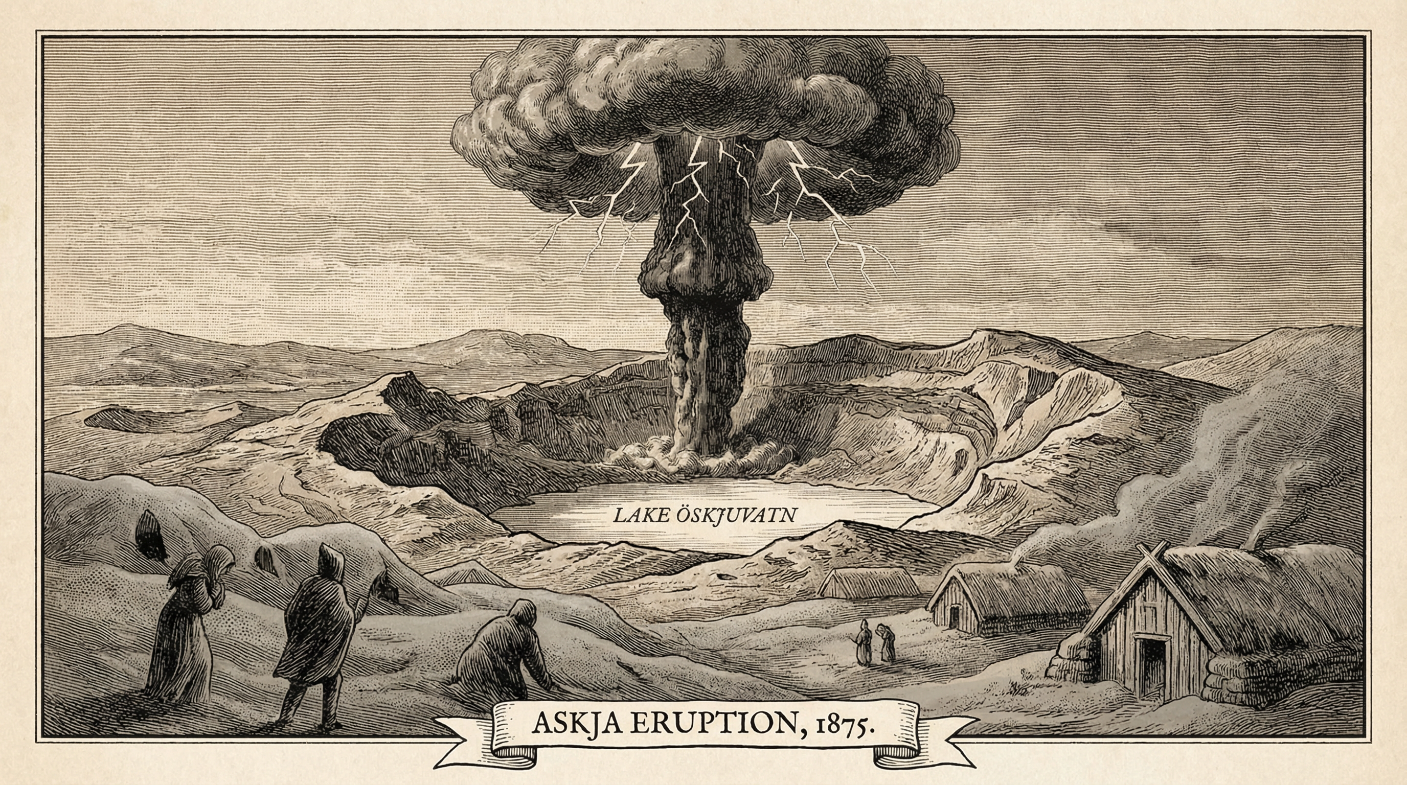
Historical engraving reconstruction of the catastrophic 1875 Askja eruption (AI-generated)
🤖 AI GeneratedAskja
One of the largest ash eruptions in Icelandic history. The main explosive phase began on 28 March 1875 and lasted about eight hours, erupting from Víti and other craters. The eruption column reached the stratosphere. Heavy ashfall devastated the middle of East Iceland, causing many farms to be abandoned. Thousands of East Fjord inhabitants emigrated to North America as a result. Lake Öskjuvatn was formed during this event and grew steadily thereafter.
Significance
The 1875 Askja eruption triggered one of Iceland's largest emigration waves. The VEI 5 eruption was the most powerful in Iceland in the 19th century and created Lake Öskjuvatn.
Grímsvötn subglacial eruption beneath Vatnajökull glacier (AI-generated)
🤖 AI GeneratedGrímsvötn
A subglacial eruption of Grímsvötn, one of several during the 19th century. The eruption melted significant quantities of glacial ice, contributing to periodic jökulhlaup floods across the Skeiðarársandur outwash plain.
Significance
Demonstrates the persistent eruptive activity of Grímsvötn throughout the 19th century.
20th Century
The 1918 Katla eruption with massive jökulhlaup flooding Mýrdalssandur (AI-generated)
🤖 AI GeneratedKatla
The 1918 eruption of Katla began on 12 October and ended on 5 November. The eruption column reached 14.3 km (8.9 mi) into the atmosphere. The resulting jökulhlaup was one of the largest ever recorded, with a peak discharge estimated at 200,000–300,000 m³/s — comparable to the combined flow of the Amazon and Mississippi rivers. Icebergs up to 60 metres tall were carried to the coast of Mýrdalssandur. The eruption caused considerable damage in Skaftártunga.
Significance
The most powerful Katla eruption of the 20th century and one of the largest jökulhlaups in recorded history. The flood discharge briefly exceeded that of the Amazon River.
The 1947 Hekla eruption — first eruption in over a century (real photo)
📷 Real PhotoHekla
Hekla's 14th recorded eruption began on 29 March 1947 with a massive explosion — the first eruption in over 100 years. The eruption plume reached 30 km (19 mi) into the stratosphere. The Heklugjá fissure opened along the volcano's entire length. About 0.8 km³ of lava flowed, mostly to the west and southwest. Heavy ashfall covered Fljótshlíð and Eyjafjöll to the south. One Icelandic geologist died while conducting research at the eruption site.
Significance
The first eruption of Hekla in 102 years, and one of the most powerful of the 20th century. The eruption fundamentally changed scientific understanding of Hekla's behaviour.
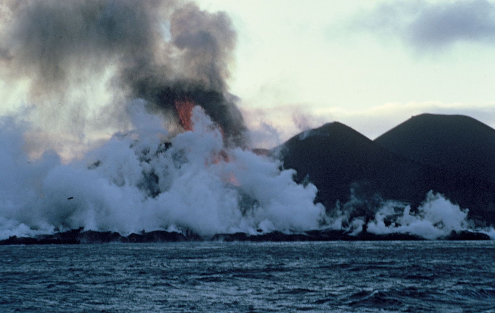
Surtsey island emerging from the Atlantic Ocean in 1963 (real photo)
📷 Real PhotoSurtsey
Surtsey rose from the sea on 14 November 1963 in an underwater eruption that began 130 metres below sea level. The eruption lasted until 5 June 1967, when the island reached its maximum size of 2.7 km². The eruption was characterised by spectacular surtseyan explosions as lava met seawater, creating towering columns of steam, ash, and volcanic bombs. The island was named after Surtur, the Norse fire giant. It is now a UNESCO World Heritage Site and a unique natural laboratory for studying the colonisation of new land by life.
Significance
The birth of a new island gave scientists an unprecedented opportunity to observe the formation of new land and the colonisation of a sterile volcanic island by life. A new type of volcanic eruption — the "surtseyan" eruption — was named after this event.
The 1970 Hekla eruption with lava fountains and ash cloud (AI-generated)
🤖 AI GeneratedHekla
Hekla's 15th eruption began on 5 May in the southwestern part of Heklugjár and in Skjólkvíar north of the mountain. Considerable ashfall spread to the north-northwest, reaching as far as Húnavatnssýslur. Activity in the main fissure stopped after a few days, but eruptions at Skjólkvíar continued for about two months.
Significance
Demonstrated Hekla's new pattern of more frequent, smaller eruptions following the 1947 reawakening.
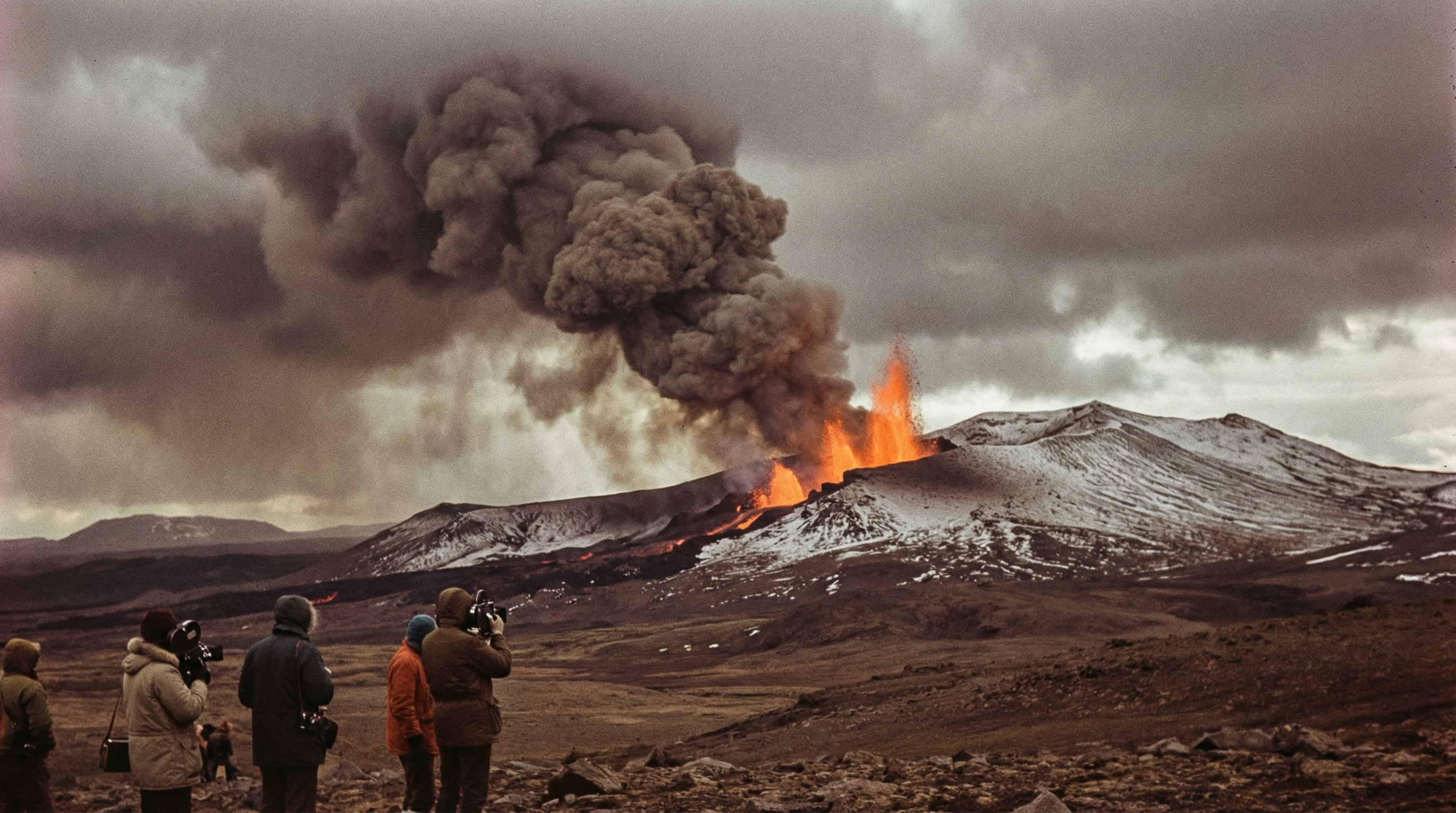
Eldfell eruption engulfing houses in Vestmannaeyjar, January 1973 (real photo)
📷 Real PhotoEldfell
On 23 January 1973, a 1,600-metre eruption fissure opened east of the town of Vestmannaeyjar on Heimaey island with no warning. The entire population of 5,300 was evacuated by boat within hours. About a third of the town was buried under lava and ash, with over 400 properties destroyed. In a remarkable engineering effort, firefighters pumped seawater onto the advancing lava front, successfully cooling and halting it just before it would have closed the vital harbour entrance. A new volcano — Eldfell — was formed, and Heimaey expanded to the east.
Significance
The only inhabited place in Iceland directly threatened by a lava flow. The successful use of seawater to halt lava advance became a landmark in volcanic hazard management. The harbour was saved, and the town was rebuilt.
Krafla lava eruption near Lake Mývatn, 1975–1984 (real photo)
📷 Real PhotoKrafla (Mývatn Fires)
The Krafla Fires (Kröflueldar) consisted of nine eruption episodes between 1975 and 1984, the most recent in the long history of the Mývatn Fires. The first eruption on 20 December 1975 produced lava from a short fissure at Leirhnjúkur. Subsequent eruptions followed in 1977, 1980, 1981, and 1984. The eruptions were associated with magma intrusions and deflation of the Krafla caldera. The 1984 eruption (4–18 September) was the largest, producing extensive lava flows.
Significance
The Krafla Fires provided invaluable scientific data on rifting processes and magma dynamics. The Krafla geothermal power station, under construction during the eruptions, was directly threatened but ultimately survived.
Hekla eruption in the late 20th century (AI-generated)
🤖 AI GeneratedHekla
Hekla's 16th eruption began on 17 August 1980 and lasted until the 20th. Ash spread to the north, and lava flowed mostly to the west and north. The eruption resumed on 9 April 1981 and ended on 16 April.
Significance
Demonstrated Hekla's new pattern of more frequent eruptions, with only 10 years since the 1970 eruption.
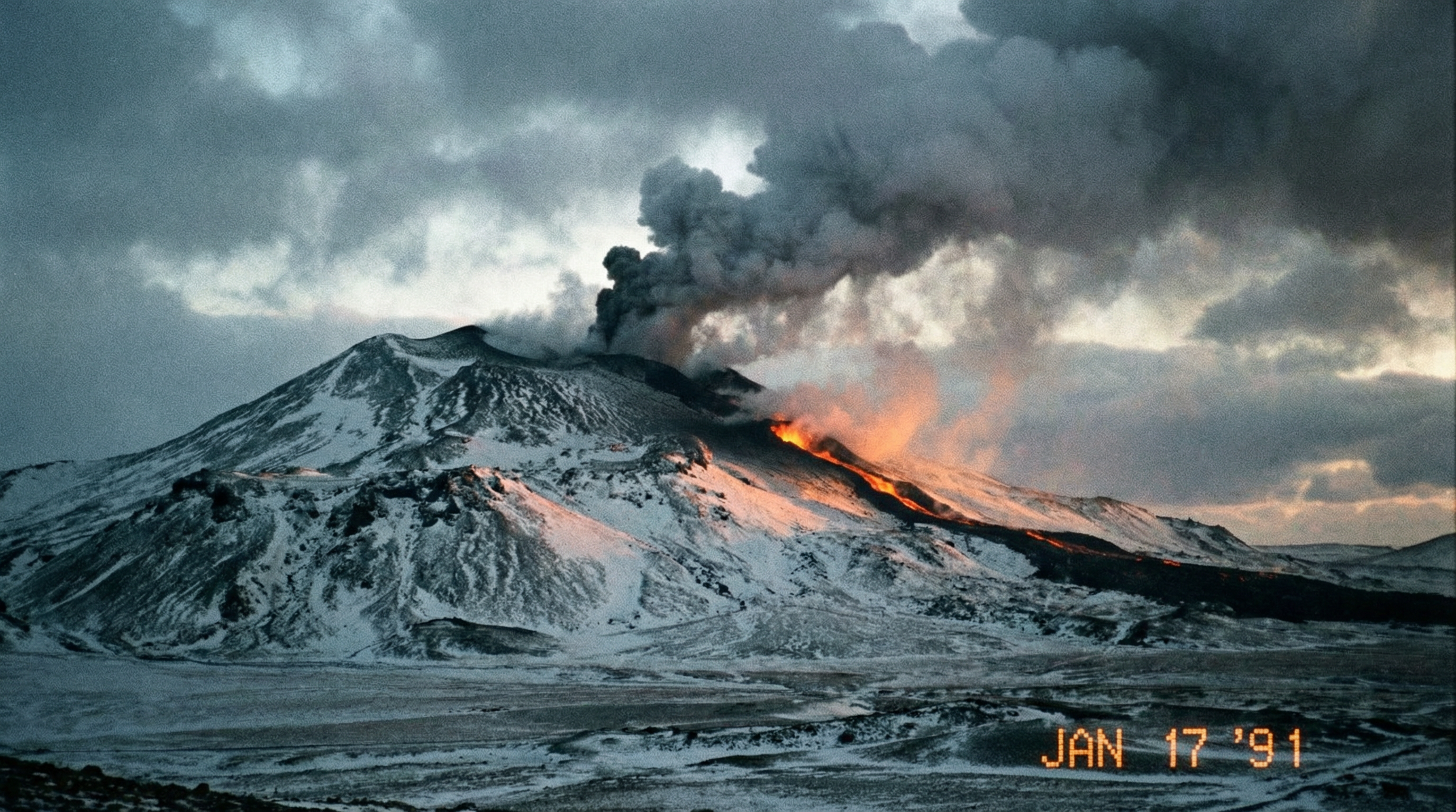
The 1991 Hekla eruption in winter conditions (AI-generated)
🤖 AI GeneratedHekla
Hekla's 17th eruption began on 17 January in the southern part of Heklugjár but soon subsided. One crater east of the mountain remained active until 17 March. A considerable amount of lava flowed on the south side of the mountain, but there was little ashfall. The eruption was notable for its rapid onset — warning time was less than an hour.
Significance
The 1991 eruption highlighted the challenge of providing adequate warning for Hekla eruptions, which can begin with very little precursory activity.
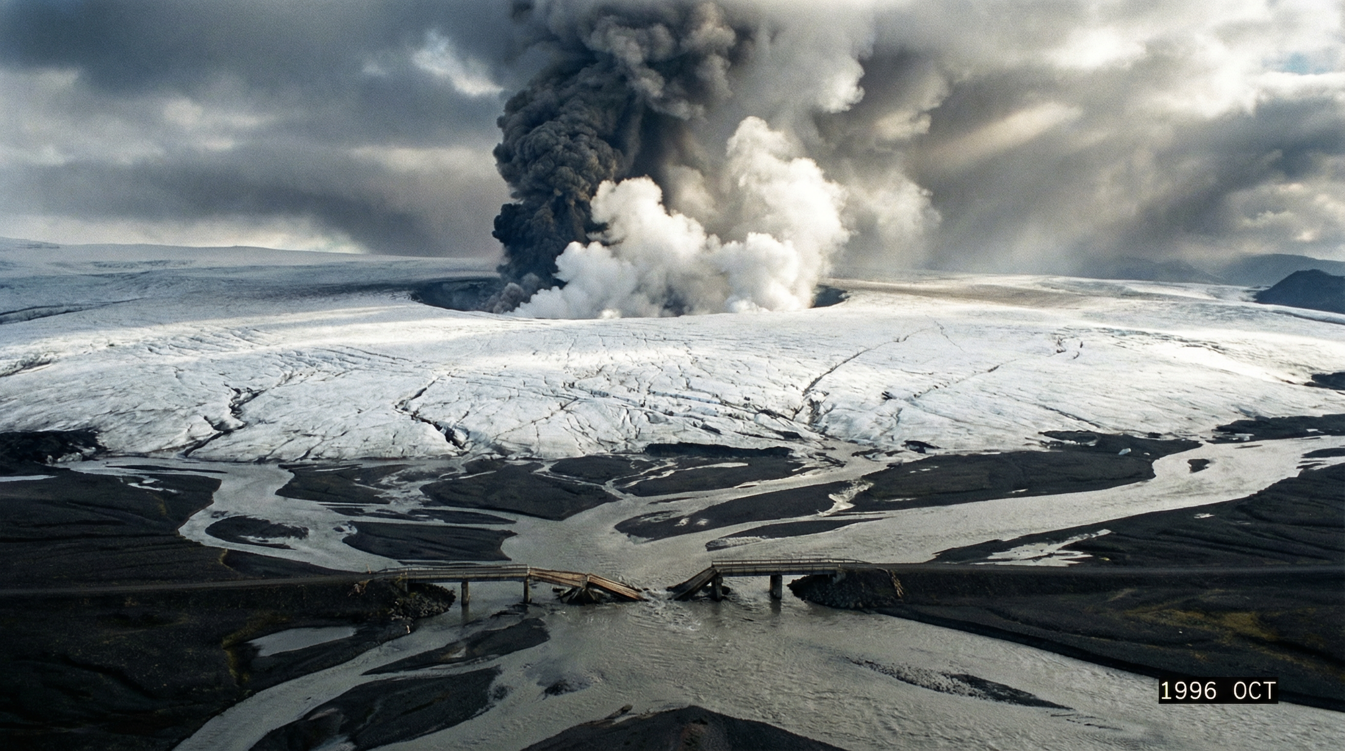
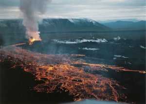
The 1996 Gjálp subglacial eruption with jökulhlaup flooding Skeiðarársandur (AI-generated)
🤖 AI GeneratedGjálp (Bárðarbunga)
On 30 September 1996, an eruption began on a 4–5 km fissure under Vatnajökull between Bárðarbunga and Grímsvötn. Seismic activity indicated a magma flow from Bárðarbunga. The subglacial eruption melted enormous quantities of ice, and meltwater flowed to Grímsvötn, filling the subglacial lake to its highest level ever recorded. On 5 November, the long-awaited jökulhlaup burst out, submerging the Skeiðarársandur outwash plain and destroying several bridges on the Ring Road.
Significance
The first eruption to be monitored in real-time using GPS, radar, and seismology. The jökulhlaup destroyed bridges on Iceland's Ring Road and temporarily severed the country's main road circuit.
21st Century
Hekla eruption at the turn of the millennium (AI-generated)
🤖 AI GeneratedHekla
Hekla's 18th recorded eruption began on 26 February 2000 and lasted until 8 March. The eruption began with only 20 minutes of warning — the shortest warning time ever recorded for a Hekla eruption. Lava flowed to the north and northeast, and ashfall was relatively minor.
Significance
The shortest warning time ever recorded for a Hekla eruption — just 20 minutes — underscored the extreme challenge of monitoring this volcano.
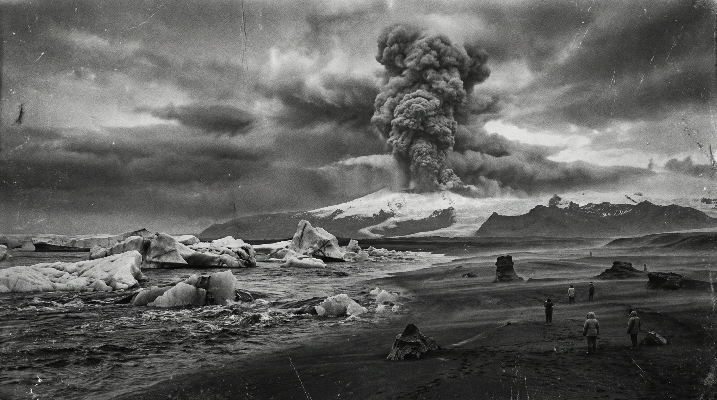
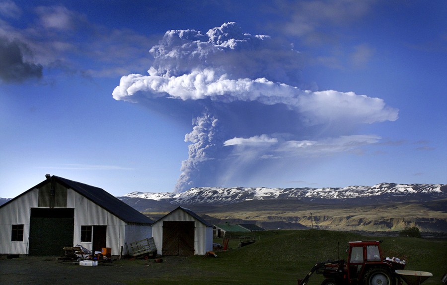
The iconic ash plume of Eyjafjallajökull in April 2010 (real photo)
📷 Real PhotoEyjafjallajökull
The eruption began at Fimmvörðuháls on 20 March 2010, initially producing spectacular lava fountains accessible to the public. On 14 April, a far more powerful explosive eruption began beneath the Eyjafjallajökull glacier, producing a fine ash plume that rose to 9 km. The interaction of magma with glacial meltwater created extremely fine ash particles that were carried across Europe by prevailing winds. The eruption caused the largest disruption to European airspace since World War II, grounding over 100,000 flights and stranding 10 million passengers.
Significance
The most economically disruptive volcanic eruption in modern history, costing the aviation industry an estimated €1.3 billion. It fundamentally changed how aviation authorities respond to volcanic ash clouds.
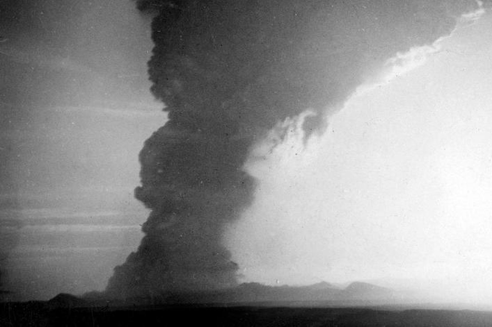
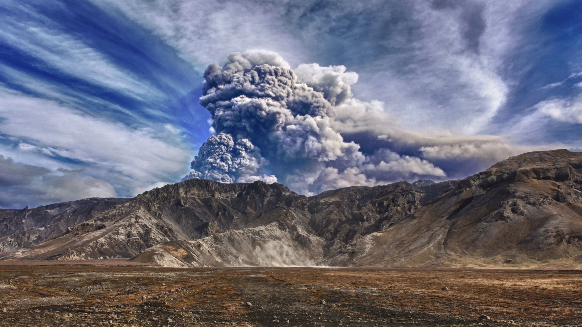
The massive Grímsvötn eruption column on 21 May 2011 (real photo)
📷 Real PhotoGrímsvötn
The 2011 Grímsvötn eruption began on 21 May and was the most powerful eruption in Iceland in 50 years. The Plinian eruption column reached 20 km into the stratosphere. Ash fell across Iceland and spread to northern Europe, causing disruption to air travel from 22–25 May 2011. The eruption was far more powerful than the 2010 Eyjafjallajökull event but caused less disruption due to favourable wind patterns.
Significance
The most powerful Icelandic eruption since Hekla 1947, with a VEI of 4. Despite its greater power than Eyjafjallajökull 2010, the coarser ash fell out more quickly, limiting aviation disruption.
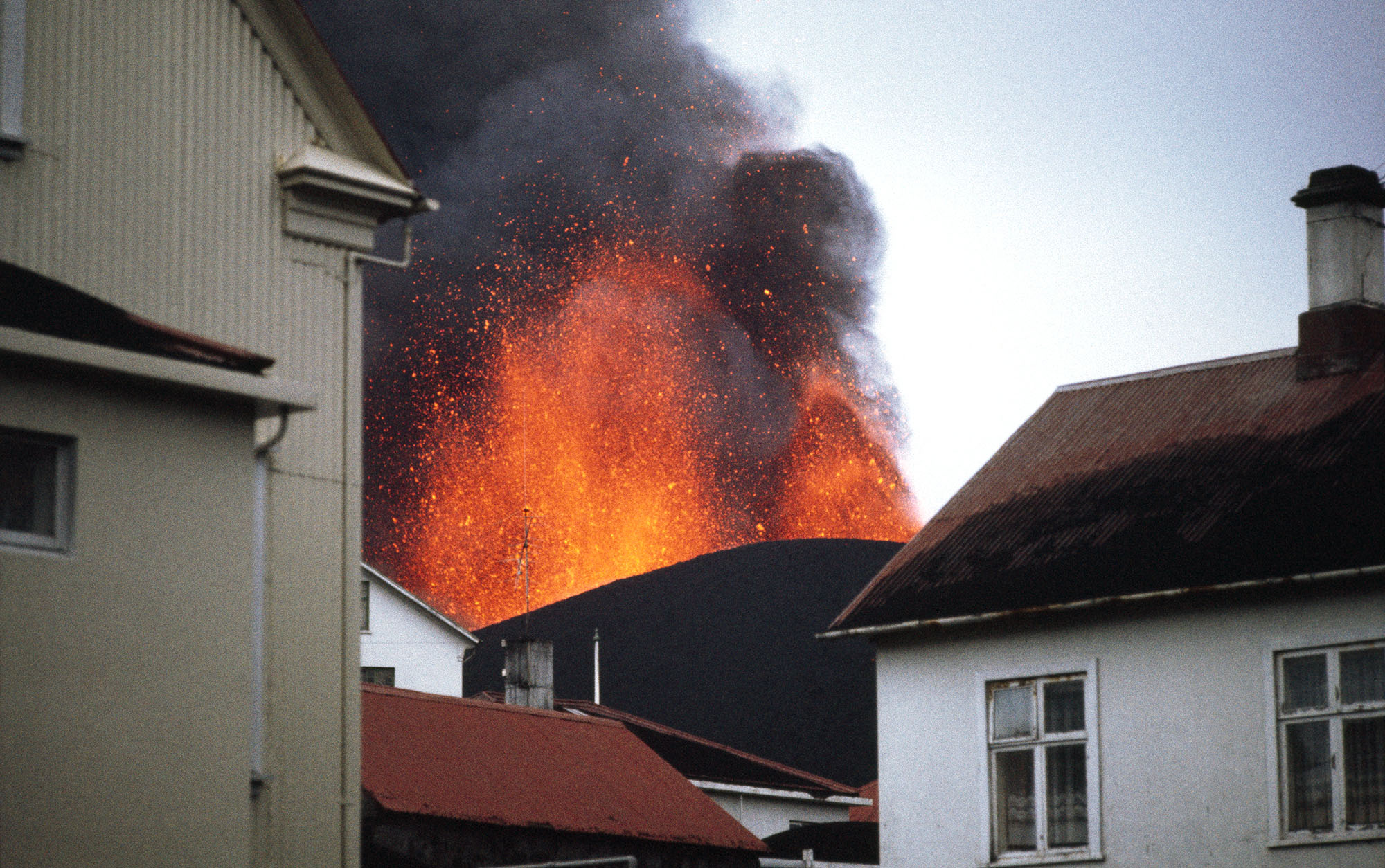
Aerial view of the Holuhraun lava eruption, 2014 (real photo)
📷 Real PhotoHoluhraun / Bárðarbunga
The Holuhraun eruption began on 29 August 2014 following a massive earthquake swarm at Bárðarbunga. Magma migrated 45 km northeast from Bárðarbunga along a dyke intrusion before erupting at the surface in the Holuhraun lava field. The eruption lasted until 28 February 2015 and produced approximately 1.4 km³ of lava — the largest lava eruption in Iceland since the 1783 Laki eruption. The eruption emitted enormous quantities of sulphur dioxide, causing severe air quality problems across Iceland.
Significance
The largest lava eruption in Iceland in 230 years, covering an area of 84 km². The SO₂ emissions caused widespread air quality alerts across Iceland and were detectable across Europe.
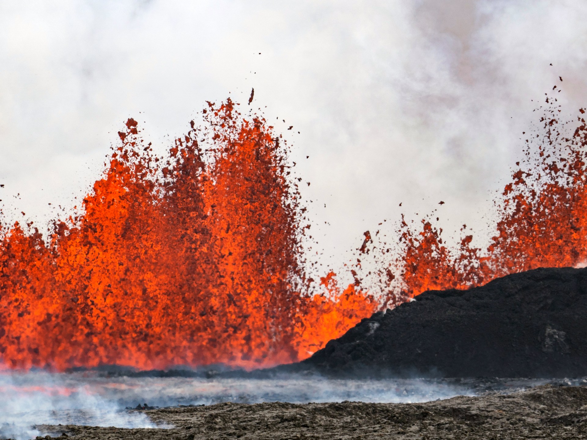
Visitors watching the Geldingadalir eruption from the surrounding ridges (real photo)
📷 Real PhotoFagradalsfjall (Geldingadalir)
The eruption began in the valley of Geldingadalir on 19 March 2021 — the first eruption on the Reykjanes Peninsula in 800 years. The eruption was effusive, producing slow-moving lava flows from a single vent that gradually expanded. The accessible location attracted hundreds of thousands of visitors who hiked to watch the eruption safely. Lava eventually flowed into the Meradalir and Nátthagi valleys, covering approximately 4.8 km². The eruption ended on 18 September 2021.
Significance
The first eruption on the Reykjanes Peninsula since 1240 AD, marking the beginning of a new eruptive period on the peninsula. The accessible nature of the eruption made it one of the most-visited volcanic events in history.
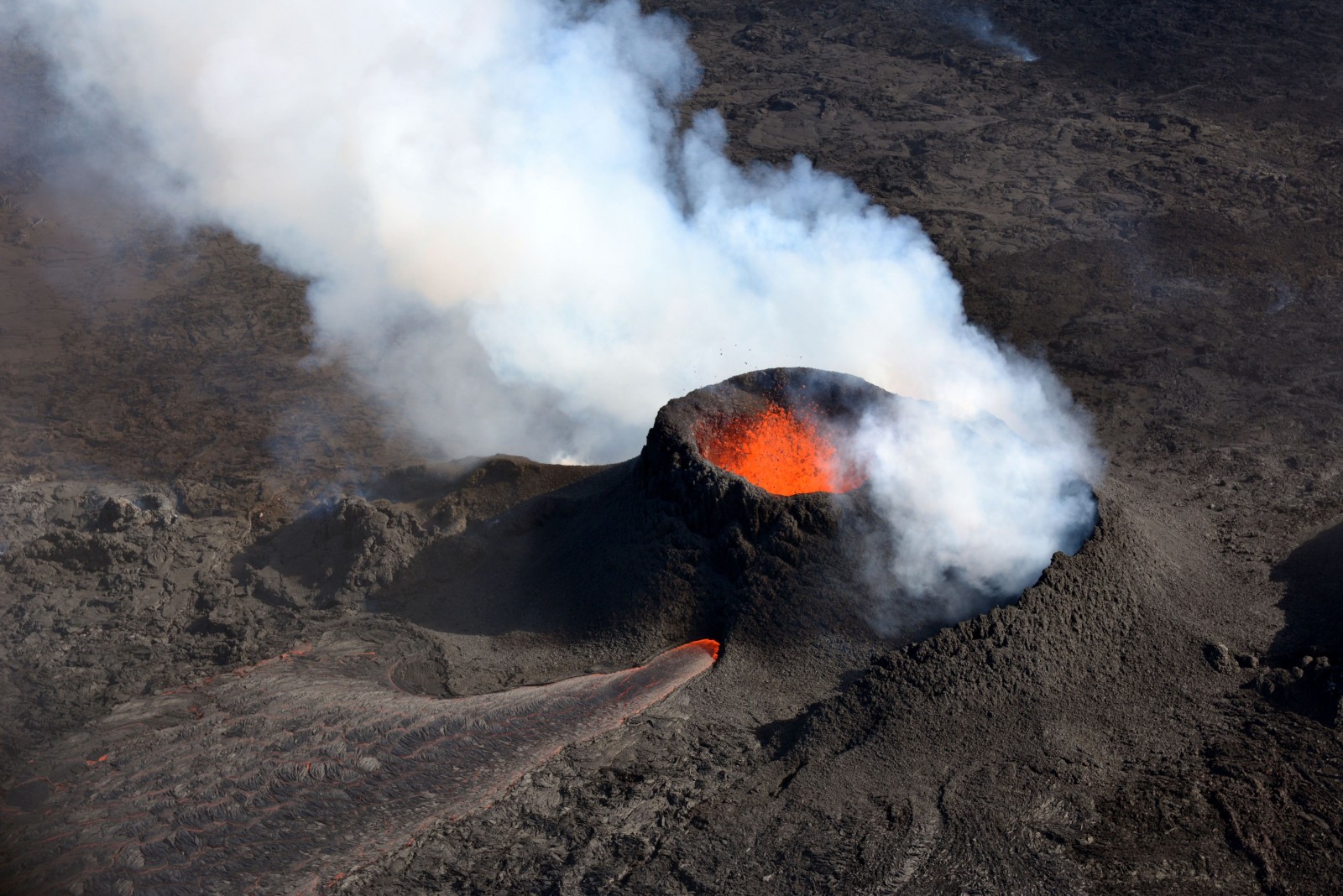
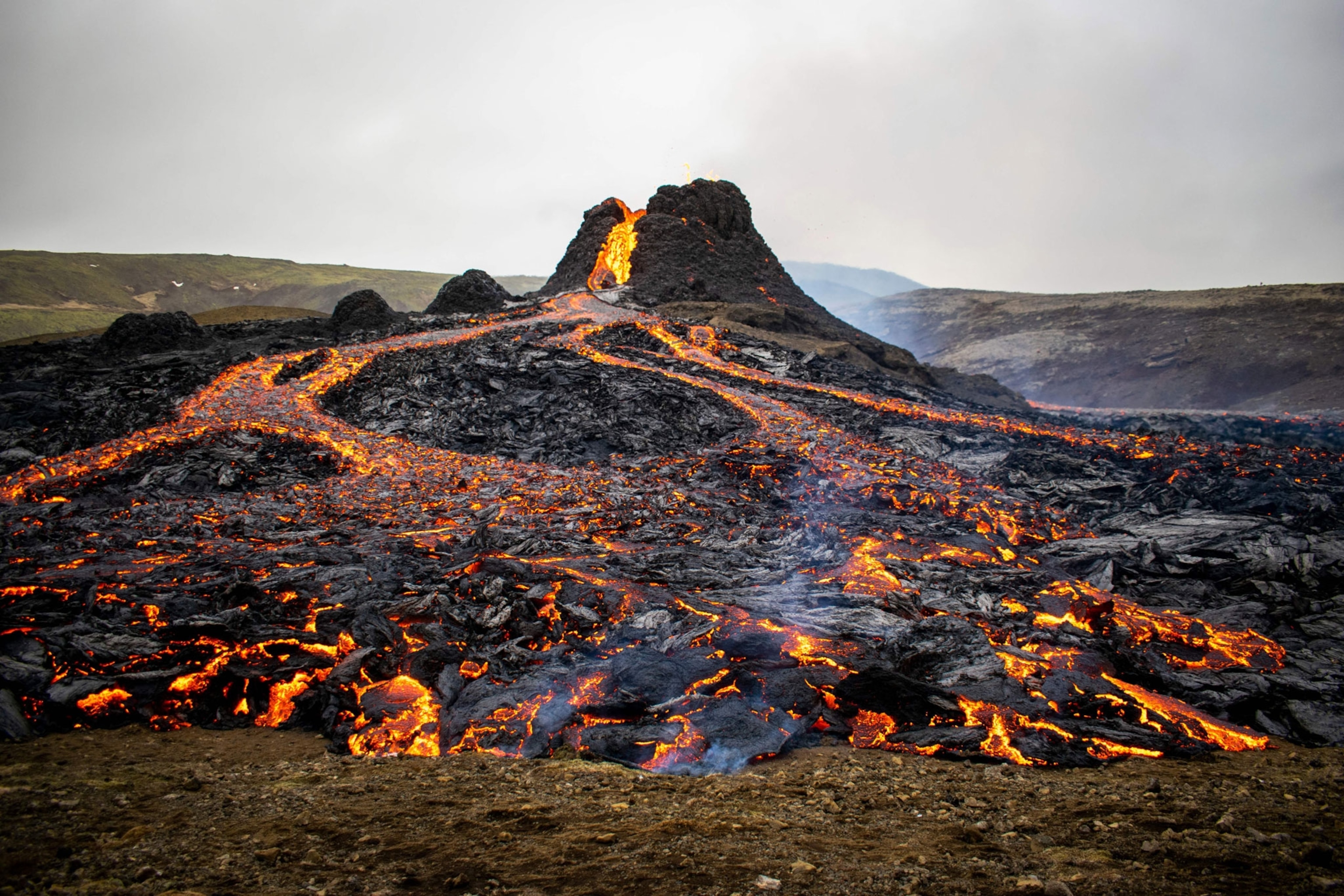
The 2022 Meradalir eruption with lava fountains at sunset (AI-generated)
🤖 AI GeneratedFagradalsfjall (Meradalir)
The second eruption in the Fagradalsfjall area began on 3 August 2022 in the Meradalir valley, approximately 1 km northeast of the 2021 eruption site. The eruption produced lava fountains up to 50 metres high and extensive lava flows. It attracted large numbers of visitors before ending on 21 August 2022.
Significance
Confirmed that the Reykjanes Peninsula had entered a new phase of volcanic activity, with eruptions occurring in quick succession for the first time in centuries.
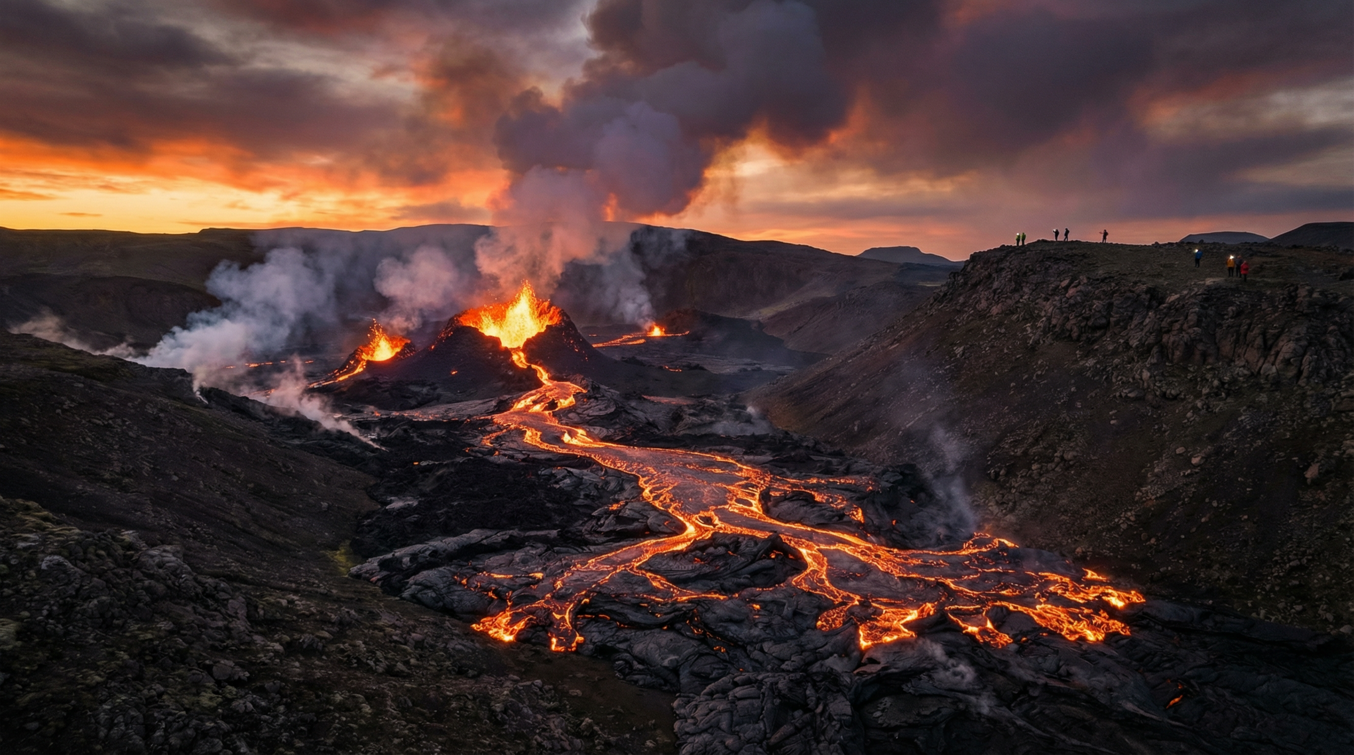
Reykjanes Peninsula eruption in 2023 (real photo)
📷 Real PhotoLitli-Hrútur (Fagradalsfjall 3)
The third eruption in the Fagradalsfjall area began on 10 July 2023 at 16:40 UTC, north of the Litli-Hrútur volcanic fell. This eruption was larger than the two previous Fagradalsfjall eruptions, with considerable lava flow covering a larger area. The eruption was accessible to hikers and attracted significant public interest.
Significance
The third consecutive eruption in the Fagradalsfjall area within three years, reinforcing the pattern of renewed volcanic activity on the Reykjanes Peninsula.
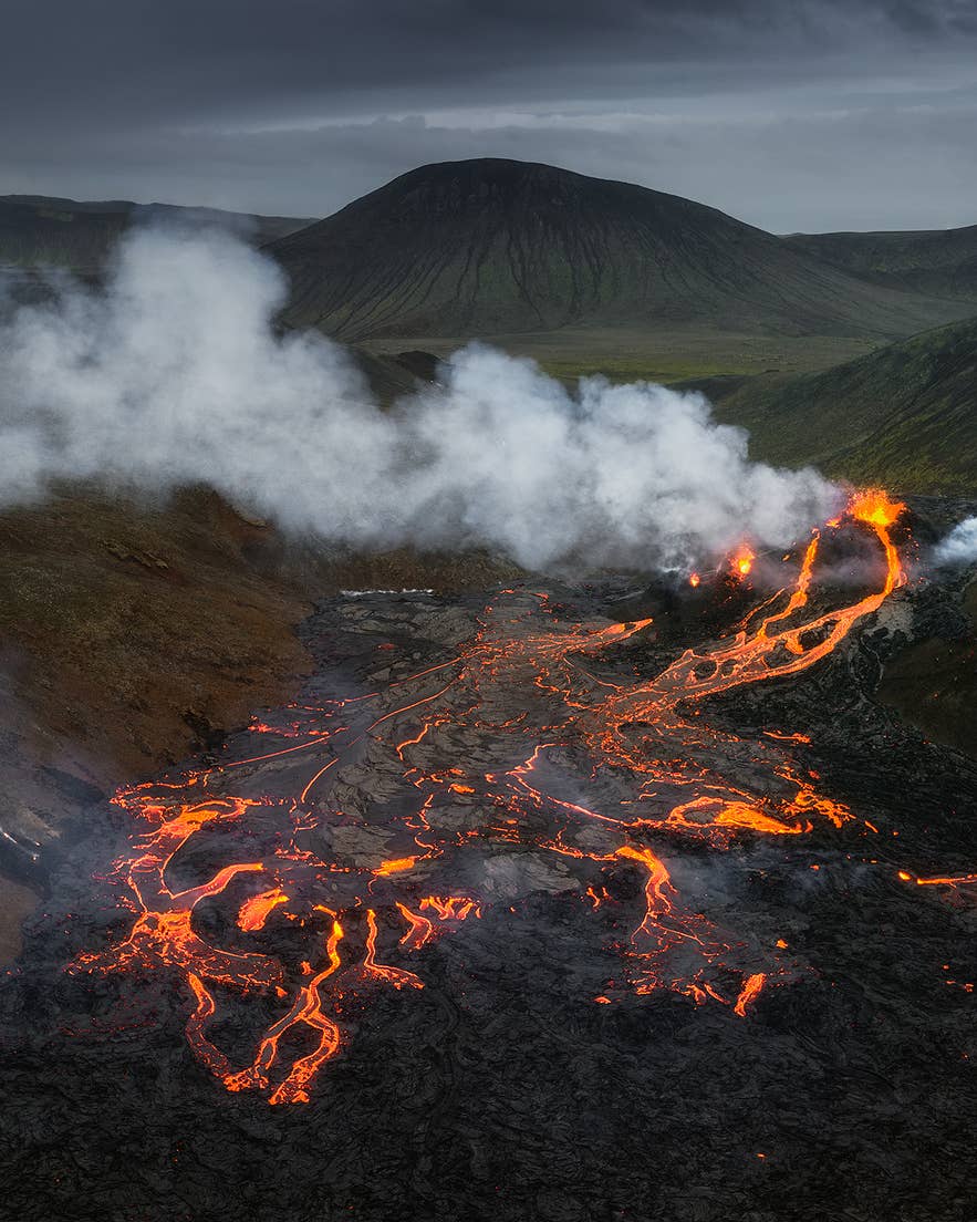
Sundhnúkur lava fissure eruption near Grindavík, December 2023 (real photo)
📷 Real PhotoSundhnúkur
A series of lava fissure eruptions began on 18 December 2023 at the Sundhnúkur crater chain, north of the town of Grindavík. The first eruption lasted 3 days. Subsequent eruptions followed in January, February, March, May, August, and November 2024, and April 2025. Several eruptions sent lava toward Grindavík, forcing repeated evacuations. Defensive earthen barriers were constructed to protect the town and the Svartsengi geothermal power plant. The May 2024 eruption was the largest in the series.
Significance
The most sustained volcanic crisis in Iceland's modern history, with 8+ eruptions in rapid succession threatening the town of Grindavík and critical infrastructure. The Blue Lagoon geothermal spa was temporarily closed and damaged. The eruptions represent a new eruptive system on the Reykjanes Peninsula.
Complete Record
All Confirmed Eruptions
Chronological record of all confirmed volcanic eruptions in Iceland, 1807–2025
| Year | Volcano |
|---|---|
| 1807 | Grímsvötn |
| 1816 | Grímsvötn |
| 1821 | Katla |
| 1821–1823 | Eyjafjallajökull |
| 1823 | Vatnajökull |
| 1830 | Eldeyjarboði |
| 1838 | Grímsvötn |
| 1845–1846 | Hekla |
| 1854 | Grímsvötn |
| 1860 | Katla |
| 1862–1864 | Heljargjárrein |
| 1867 | Grímsvötn |
| 1867–1868 | Tjörnes Fracture Zone |
| 1872 | Vatnajökull |
| 1873 | Grímsvötn |
| 1875 | Askja |
| 1876 | Askja |
| 1878 | Krakatindur |
| 1879 | Geirfuglasker |
| 1883 | Grímsvötn |
| 1887 | Grímsvötn |
| 1887–1889 | Thórðarhyrna |
| 1889 | Grímsvötn |
| 1892 | Grímsvötn |
| 1897 | Grímsvötn |
| 1902–1904 | Grímsvötn / Thórðarhyrna |
| 1905–1906 | Grímsvötn |
| 1908–1909 | Grímsvötn |
| 1910 | Grímsvötn / Loki-Fögrufjöll |
| 1913 | Mundafell / Lambafit |
| 1918 | Katla |
| 1921–1929 | Askja |
| 1922 | Grímsvötn |
| 1923 | Grímsvötn |
| 1927 | Esjufjöll |
| 1933–1934 | Grímsvötn |
| 1947–1948 | Hekla |
| 1961 | Askja |
| 1963–1967 | Surtsey |
| 1970 | Hekla |
| 1973 | Eldfell |
| 1975–1984 | Krafla (Mývatn Fires) |
| 1980–1981 | Hekla |
| 1983 | Grímsvötn |
| 1991 | Hekla |
| 1996 | Gjálp (Bárðarbunga) |
| 1998 | Grímsvötn |
| 2000 | Hekla |
| 2004 | Grímsvötn |
| 2010 (Mar) | Eyjafjallajökull (Fimmvörðuháls) |
| 2010 (Apr) | Eyjafjallajökull |
| 2011 | Grímsvötn |
| 2014–2015 | Holuhraun / Bárðarbunga |
| 2021 | Fagradalsfjall (Geldingadalir) |
| 2022 | Fagradalsfjall (Meradalir) |
| 2023 (Jul) | Litli-Hrútur |
| 2023–2025 | Sundhnúkur |